|
||||
Legend
|
||||
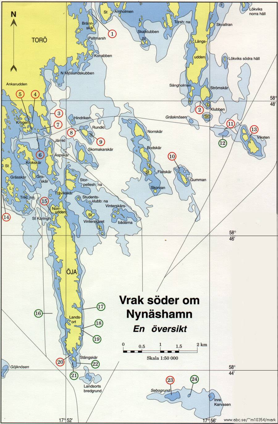
Name 1. Margareta |
Pos. North / East58º 49' 32/ 17º 52' 70 |
Sunk year1898 |
Depth, metres10 |
Descriptionbrig |
| 6. Trubbnos/Severn 7. Wooden wreck 8. Snapp 9. Fyrspännaren 10. Wooden wreck |
58º 47' 55/ 17º 51' 19 58º 47' 59/ 17º 51' 28 58º 47' 58/ 17º 52' 42 58º 47' 53/ 17º 52' 64 58º 46' 98/ 17º 55' 19 |
1834 ? 1947 18th c ? |
9 20 9 |
brig |
| 11. Gaude 12. Rita 13. Riksnyckeln 14. Wooden wreck 15. TB 388 |
58º 47' 56/ 17º 56' 41 58º 47' 47/ 17º 56' 33 58º 47' 44/ 17º 57' 09 58º 46' 64/ 17º 50' 27 58º 46' 33/ 17º 51' 63 |
1919 1959 1628 ? 1957 |
15 15 8-15 30-35 |
French ship man-of-war |
| 16. Paula Faulbaum 17. Hansa 18. Örnen 19. Oleg Koshevoi 20. Argo |
58º 44' 89/ 17º 51' 62 58º 44' 92/ 17º 52' 47 58º 44' 62/ 17º 52' 49 58º 44' 60/ 17º 52' 45 58º 44' 22/ 17º 52' 12 |
1941 1917 1932 1946 1924 |
40-70 26 22 27 20 |
German steel ship iron ship tugboat Russian steel ship |
| 21. Glan 22. Heimdal 23. Göte 24. Nicke 25. Wooden wreck |
58º 44' 13/ 17º 52' 20 58º 44' 11/ 17º 52' 28 58º 43' 60/ 17º 54' 90 58º 43' 62/ 17º 55' 47 58º 51' 51/ 17º 55' 32 |
1943 1957 1906 1942 ? |
10 15 |
|
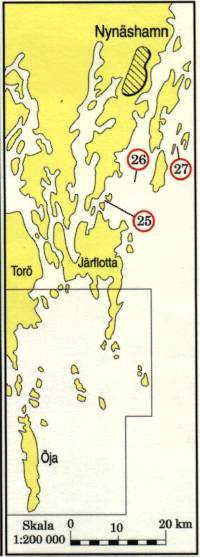
| 26. Fridhem 27. The Tattran wreck |
58º 51' 96/ 17º 56' 76 58º 52' 83/ 17º 58' 89 |
? ? |
small wooden ship old wooden wreck |
|
|
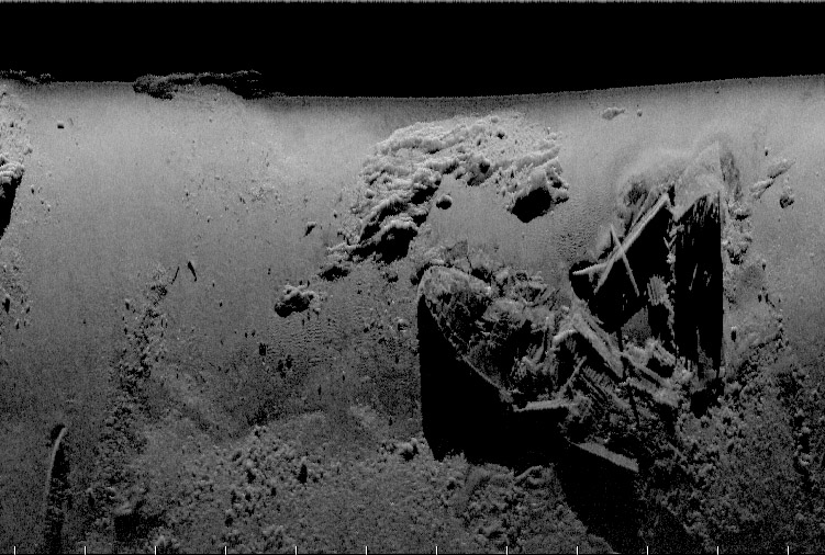
This material is a cartographic student work by Julijana Radakovits, Geographical Institution, Stockholm University, 1992-93. The wreck positions are from the Swedish maritime museum's wreck register. The map is not a sea chart and should not me used for navigation. Sinking years and depths are completed by Per Åkesson. This document is for information only; some of these wrecks are not suitable for scuba diving. Translation & layout: Per Åkesson, July 1998 Images & Further reading #6: Trubbnos/Severn af Carlscrona Södertörn a maritime landscape in a long term perspective, Dr Johan Rönnby |
||||
 Back to Nordic Underwater Archaeology
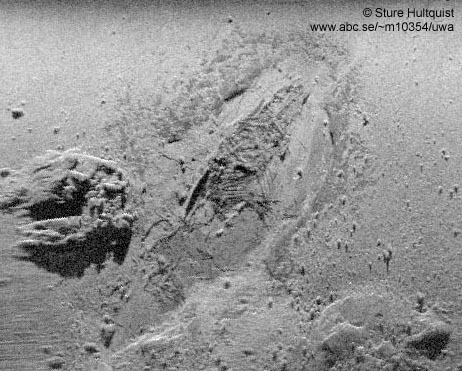