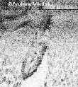
Search tools & techniqueBefore a wreck is located, it's often necessary to search archives and ask fishermen where nets get stuck. In the Mediterranean, sponge divers have similar information. Wrecks can be located exactly using scuba diving, magnetometer or metal detector, sonar, side scan sonar with GPS satellite navigator and video plotter. Sometimes air survey can be used. A new exciting method is laser bathymetry. A helicopter sweeps an area emitting laser pulses. So far sea bottom has been charted down to 30 m depth and the method is constantly developing.
|
side scan sonar |
 Back to Nordic Underwater Archaeology