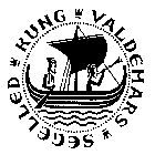
King Valdemar's Sailing Route
 In the 13th century the main
sailing route in the Baltic Sea was written down. This itinerary is preserved in a handwriting called
Liber Census Daniae or kung Valdemars jordebog, after the Danish king. The actual
sailing route is called king Valdemar's sailing route. It is the oldest existing
description of its kind. The text lists several place names, believed to have been pilot stations. The
route went close to the coast of the mainland. Perhaps this was in order to profit from the sea breeze.
Perhaps it was because the oldest ships used oars rather than sail. Nobody knows. Not until the 14th
century, deep-sea offshore shipping became common, using large cogs and
navigating with the newly-invented compass. In the 13th century the main
sailing route in the Baltic Sea was written down. This itinerary is preserved in a handwriting called
Liber Census Daniae or kung Valdemars jordebog, after the Danish king. The actual
sailing route is called king Valdemar's sailing route. It is the oldest existing
description of its kind. The text lists several place names, believed to have been pilot stations. The
route went close to the coast of the mainland. Perhaps this was in order to profit from the sea breeze.
Perhaps it was because the oldest ships used oars rather than sail. Nobody knows. Not until the 14th
century, deep-sea offshore shipping became common, using large cogs and
navigating with the newly-invented compass.
It is presumed that prehistoric sailing routes went more or less along king Valdemar's sailing route.
The itinerary
The text is in Latin but the place names are written with old Norse spelling. Almost all places have
been identified.
The route starts at Utlängan in South Sweden near Denmark. It continues along the Baltic coast to the
Stockholm archipelago. Finally it passes Åland, south Finland and ends in Reval (Tallinn, Estonia).
Presently an effort is made to investigate the old route more closely. The
Aluett expedition in 1996 was a small part of this project.
Land rise
One problem for modern sailors is that the old route is partially impossible to follow. The reason is
the continuous land rise around the Baltic Sea.
During the last ice age, that ended about 10,000 years ago, Scandinavia had been depressed by
billions of tons of ice. When the heavy ice was gone, the land started to rise. It still rises very
slowly. The present land rise is about 15 to 40 cm per century, depending on where you are. The rate is
highest in the north.
This also means that old wrecks and underwater finds in the Baltic Sea, are not at the same depth as
when they sank. One example is the Södertörn area.
Per Åkesson, Feb 1999
Related topic
Ancient navigation
Sources
- Axel Härlin: "Vår äldsta seglingsbeskrivning" (Till Rors nr 10, 1942)
- C O Cederlund: "Sjövägarna vid svenska Östersjökusten på 1200-talet" (Marinarkeologisk
tidskrift 3/1989)
- C O Cederlund: "Forskare till rors kartlägger sjöväg från 1200-talet" (Forskning
och framsteg nr 5, 1993)
- "Kung Valdemars segelled" (Rikantikvarieämbetet/Streiffert 1995)
- Albrecht Sauer: Das Seebuch (Schriften des Deutschen Schiffahrtsmuseum, Band 44,
1996) This book describes a similar itinerary compiled during the 14th-15th centuries, located in the
Commerzbibliothek in Hamburg.
|
 In the 13th century the main
sailing route in the Baltic Sea was written down. This itinerary is preserved in a handwriting called
Liber Census Daniae or kung Valdemars jordebog, after the Danish king. The actual
sailing route is called king Valdemar's sailing route. It is the oldest existing
description of its kind. The text lists several place names, believed to have been pilot stations. The
route went close to the coast of the mainland. Perhaps this was in order to profit from the sea breeze.
Perhaps it was because the oldest ships used oars rather than sail. Nobody knows. Not until the 14th
century, deep-sea offshore shipping became common, using large
  Back to Nordic Underwater Archaeology