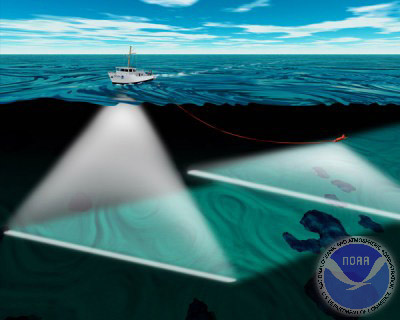
Hull-mounted multibeam sonar (left) and towed side scan sonar (right).
Hull-mounted multibeam sonar (left) and towed side scan sonar (right).
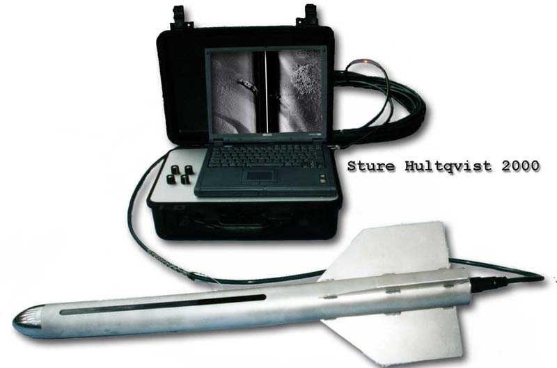
This technique was developed by Professor Harold Edgerton and others in the 1960s. It is a sonar that can look sideways. This can be compared with a radar, but uses sound echoes instead of electromagnetic pulses. The sound pulses are usually on frequencies between 100 and 500 KHz. A higher frequency gives better resolution but less range. The photo shows a portable system made by Sture Hultquist. It consists of a “fish” towed after the search ship at slow speed, connected by a cable to the terminal, which usually is like a portable PC. |
 |
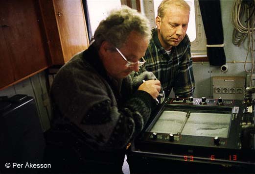 |
The sound pulses are most commonly transmitted from a towfish, but there are also hull-mounted versions. The pulses are sent in a wide angular pattern down to the
bottom, and the echoes are received back in fractions of a second. Thus each
pulse lets us “see” a narrow strip below and to the sides. As the fish
advances, an image is displayed on a monitor or a paper plotter. The photo shows a paper plotter terminal, EG&G Model 260. |
| To search an area, it's necessary to follow a search pattern perhaps aided by GPS and a video plotter. A calm sea and a straight course are necessary for a legible result. Mostly, the result is just an image of the seabottom or rough wreck images without much detail. |
 |
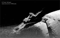 |
However, under optimal conditions, a sonogram can be very sharp and detailed, like a photo. This is Paula Faulbaum laying on 70 m depth since 1941. Click on the image for full story and larger sonograms. |
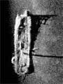
| Here's Soviet submarine S7 on 40-45 m depth off the Swedish east coast. She was sunk in 1942. Click on image for more. | 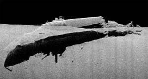 |
 |
The Mast Wreck, unidentified 18th century ship on 30 m depth. The standing mast is clearly visible on the image. Click on it for more. |
| Nedjan resting on 32 m depth. Built in 1893, sunk in 1954 and found in 1996. Click on image for more. | 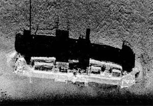 |
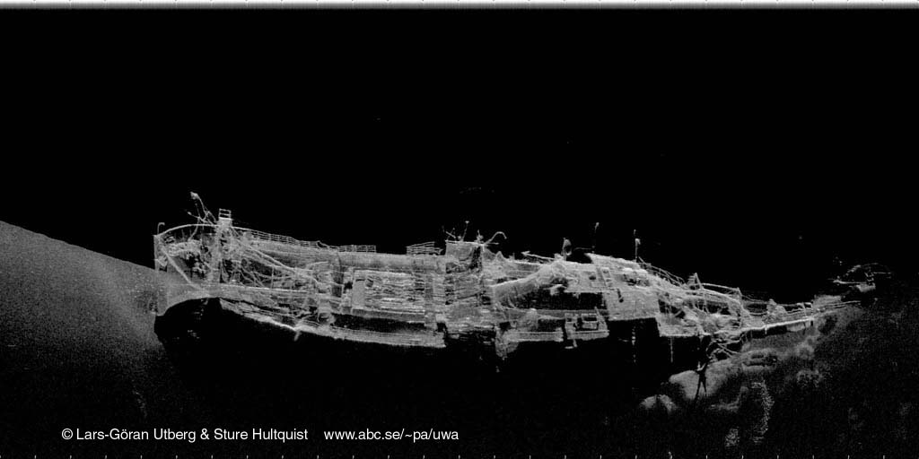 |
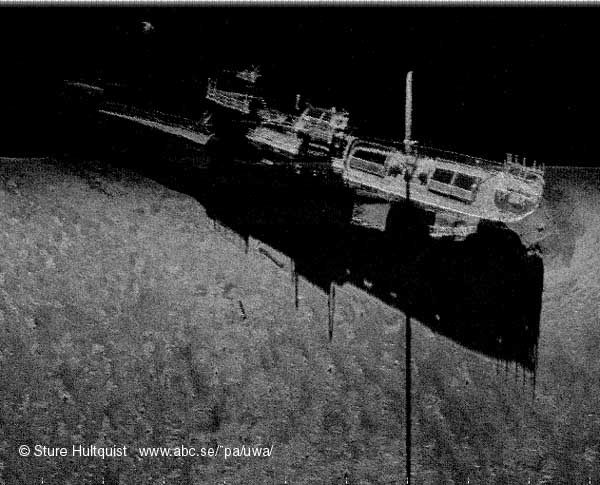
Jürgen Fritzen on 75-80 m depth. She sank off the Swedish coast in 1940. Choose between 50 kb (large) and 150 kb (huge). Here you see plenty of details: anchor, chain links, railings, funnel, hatches, etc. |
| Hertha, sunk off the Swedish coast in 1922, on 65 m depth. Click for larger image. | 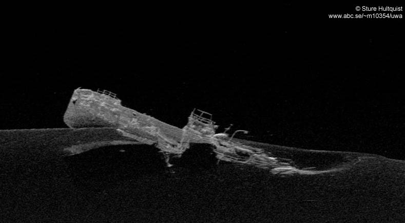 |
 |
Vesta, sunk in 1945 in 40 m depth off Öregrund, in the north Baltic Sea. |
What will be the next step? Theoretically it's possible to use two parallel
units to create a 3D-image, directly into a computer. Who will be the first to
present such results?Further readingLinks
Literature
|
Per Åkesson, 1999
Sonar drawing © Hydrographic Surveys Division, Office of Coast Survey, NOS, NOAA. Sonograms © Marin Dokumentationsteknik AB & Sture Hultquist. Page rev maj '10
 Back to Nordic Underwater Archaeology
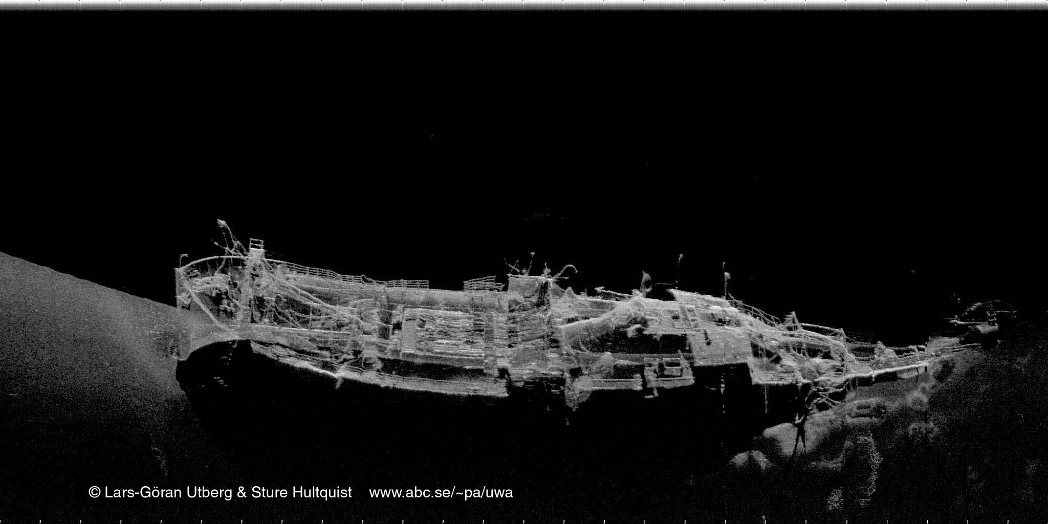